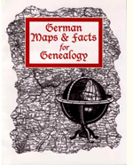
German Maps & Facts For Genealogy is a book by by Wendy Uncapher & Linda Herrick. This book points out the uniqueness of Germany in over 100 maps including detailed historic maps of kingdoms, duchies, and principalities, to hand-rendered maps showing the religion of the states, location of major rivers, and what was included in Prussia. The following maps are included:
- German Settlement Growth – showing the evolution of German settlement from abt. 700 AD through the early 1800s
- Germany 1892 (detailed map from the Chicago Chronicles Unrivaled Atlas of the World, Rand McNally & Company, Chicago 1901. The map includes an index to the major cities in 1901, as well as an index to the Kingdoms, Duchies, and Principalities – making the map extremely useful
- Holy Roman Empire – 800-1806
- Confederation of the Rhone 1806-1814
- German Confederation 1815-1866
- North German Confederation 1866-1870
- German Empire (Deutsches Reich) 1871-1918
- Weimar Republic 1918-1933
- Third Reich 1833-1945
- Allied Occupation 1945-1949
- German Democratic Republic (East Germany) 1949-1990
- Federal Republic of German (West Germany) 1949-1990
- Federal Republic of Germany 1990-Present
- Germany’s European Neighbors- Post WWII-1989
- German Colonies – with explanation text and dates
- German Emigration to the U.S.
- Areas Affected by Wars – includes: Bohemian War 1618-20; Palatinate War 1621-23; Lower Saxon-Danish War 1625-29; Polish-Swedish War 1625-29; Swedish War 1630-34; Franco-Swedish War 1635-48; Treaty of Westphalia – 1648 Peace settlement for Thirty Years Was; Northern War 1655-60; Wars of Louis XIV 1667-97; Great Northern War 1700-21; War of Spanish Succession 1701-1714; Wars of Austrian Succession 1740-48; and the Seven Years’ War 1765-63 (The Third Silesian War). These are separate maps showing the regions affected by the war (as well as those unaffected)
- German Migration 1940-1951
- Historic Regions of the German Empire
- German Dialects
- German-Speaking Areas in Europe
- German-Speaking Area in Russia
- Religion – showing the regions where those of the Roman Catholic & Evangelical principally lived
- Civil Registration – showing when Civil Registration started for the regions of Germany
- Population Density about 1870
- Forest & Mountains – showing the mountain ranges and forest for Germany
- Elevation map for Germany
- Major German Rivers
- Industrial Products – showing major products of industry for Germany
- Farm Products – showing major farm products for Germany
- Farm Layout – map showing how farms were typically laid out around the villages in Germany – the example used is Maden, Hesse-Kassel
- Railway Growth – 3 maps 1850, 1866 and 1880 with a chart of early important railway links
- Ports and Shipping Routes – Trade Routes from Major Emigration Ports
- Travel Distance – showing the German Empire and relative distances
- Prussia – maps for: Brandenburg Land by 1640; by 1744; by 1793; 1806-1815; 1815-1865; 1866-1918
- Alsace-Lorraine
- Baden
- Bavaria
- Brandenburg
- Brunswick & Anhalt & Waldeck
- East Prussia
- Hanover
- Hesse
- Lippe & Schaumburg-Lippe
- Mecklenburg
- Oldenburg
- Palatinate
- Pomerania
- Posen
- Rhineland
- Kingdom of Saxony
- Province of Saxony
- Schleswig-Holstein
- Silesia
- Thuringia
- Westphalia
- West Prussia
- Wuerttemberg (Württemberg)
- Relationship Map of Central Germany 1871 – showing how the German States lay out in relationship to each other
- Detailed Map of Thuringia
Also found in this book are population charts; timelines showing why people left, where they left from, and where they were heading; migration figures; terms; lists of rivers, forests, and mountains. Following is a listing of some of the charts, text and timelines:
- Events That Affected Migration
- Most Common Reasons to Leave for all Time Periods
- Annual Migration Statistics
- German Emigration to the U.S.
- Germanic Migration in Europe
- German Migration 1940-1951
- German Dialects
- Religion – showing numbers of those of the Evangelical, Catholic, Jewish, Other, and non-Christian Religions in 1871 (by German State)
- 1875 Male & Female Population for the German States
- Population for German States in Selected Years
- Population for the German States in 1855 & 1871
- German Rivers by name of river and German state/states in which it flows
- Major Ports Used by German Emigrants – with details and timeline
- Place Names in Other Languages (German – English – French – Polish – Other)
- Terms found in Records
- Postal Codes
- Bibliography
- Index
German Maps & Facts For Genealogy is available from Family Roots Publishing; item # OBK163
