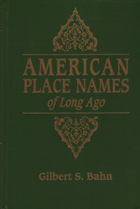
 Times change, people change, cities and towns change. Over time places disappear, become obsolete, or change names. Sometimes these places are so small, they never even appeared on the map. Finding these places, years and decade after they have gone, is not easy task. As for places found only in the past, there is one book to help researchers find locations missing from recent memory. Subtitled, A Republication of the Index to Cram’s Unrivaled Atlas of the World as Based on the Census of 1890, American Place Names of Long Ago contains over 100,000 place names from all across the United States, as they existed at the time of the 1890 census.
George F. Cram served in the Union Army during the Civil War. After the war he opened, what became at the time, the leading map publishing company in the U.S. The company was the first American firm to print a World Atlas. Cram published what is probably his best know Atlas in 1898; under the title, Cram’s Unrivaled Atlas of the World. The Atlas was 500 pages, with the final 106 pages providing a detailed index of “every county, city, town, village and post-office in the United States, and shows the population of the same according to the Census of 1890.”
This reproduction of that index was assembled by Gilbert S. Bahn. Bahn also wrote the introduction where he gives background to the project, as well as added information regarding the printing of the original Atlas and the index’s value to genealogists. The original atlas was published for popular, not academic, interest, with an emphasis on the United States. Cram could not have foreseen the future destruction by fire of the 1890 census. Nor, could he have guessed at the future value of his index in providing not just place names but population sizes for towns and cities long forgotten, yet, critical to research.
American Place Names of Long Ago lists places alphabetically by state and territory in three columns per page. Each printing column includes three columns of data. Listed first are the names of the county, town, city, village, or post office and are listed as place, county. Second, is the an index letter referring to the portion of the state in which the counties are located. Index letters include the following:
- C = Central
- N = Northern
- S = Southern
- E = Eastern
- W = Western
- N E = North-Eastern
- S E = South-Eastern
- N W = North-Western
- S W = South-Western
The Third Column denoted population. An “x” under population means the populations figures where taken together with the civil district and the exact size is unknown. State capitals and large cities are in all caps, with post-offices set in a smaller type. A black dot, “•“, indicates express offices. Places not post-offices are indicated in italics.
Gilbert estimates 35% of the places listed had populations below 100. I am not sure if anyone has actually tried to count just how many places have changed names or disappeared over time, but the number is not small. Indexes such as the one found in this book are critical to genealogical research, to finding a reference to the places people (ancestors) once lived. Contents of this book include all the states and territories as they existed in 1890. Hawaii was not yet either a territory or a state; however, the list does include the District of Columbia and Indian Territory.
Copies of American Place Names of Long Ago: A Republication of the Index to Cram’s Unrivaled Atlas of the World as Based on the Census of 1890 are available from Family Roots Publishing; Item #: GPC225, Price: $34.30.