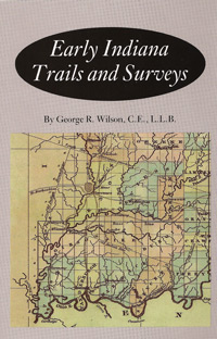
 Early Indiana Trails And Surveys was originally published in 1919 and is currently under reprint by the Indiana Historical Society Press. The book discusses the early trails and surveys in the earliest years of Indiana. These precursors to the railroad and major highways of the future were the main arteries of their day, though often they began as little more than game trails and the early paths used by Indians. The opening lines to the book give you an idea of the value of these trails:
“The most prominent early line of travel on land in southern Indiana was the Buffalo Trace, also called the ‘Kentucky Road,’ ‘Vincennes Trace,’ ‘Clarksville Trace,’ ‘Harrison’s Road,’ ‘Lan-an-zo-ki-mi-wi,’ etc. It entered Indiana at the Falls of the Ohio, passed in a northwesterly direction and left Indiana at Vincennes. As a line of travel between the same two pints, this old trail was as prominent in 1800 and previous thereto as the Baltimore & Ohio Railraod is to-day. The buffaloes passed over it in great numbers, and kept in open, in many places twenty feet wide. It was a beaten and well worn path, so prominent and conspicuous that, in 1804, it was used by General Harrison and the Indians to locate a treaty line.”
Outlined below are the contents of this volume. Upon these trails were laid the in roads to the west and the every expanding United States of the day.
Content of this volume:
Part I. EARLY TRAILS
- The Buffalo Trace
- Vallonia Trace
- Blue River Trace
- Yellow Banks Trail
- Salt Route or Trace
- Whetzels Trace
Part II. PIONEER SURVEYING IN INDIANA
Surveys made previous to the General Survey of Indiana
- The Illinois or Clark’s Grant
- Re-Survey of the Greenville Treaty Line, in 1800 – The Gore of Indiana
- The Vincennes Tract, Freeman Lines, Buckingham’s Base Line, and Second Principal Meridian. This section is complete with a copy of the Outline Map of Indiana, shoeing the districts as subdivided by the U.S. Surveyors together with each name and date of the survey.
- Special Notes and Reference on the Vincennes Tract Survey and the Freeman Lines
- Survey of the Buffalo Trail
- Survey of the “Ten O’Clock Line,” the Northeast line of the Harrison Purchase
State Line Surveys
- Survey of the North Part of the Ohio and Indiana State Line
- Survey of the Indiana and Illinois State Line
- Survey of the Michigan and Indiana State Line
Indian and Other Reservations
- Old French Surveys
- Survey of the Miami National Reserve, 1838-1839
- Thorntown Reserve
- Chief Richardville’s Reserve
- Raccoon Village Reserve
- Seek’s Village and Metea’s Village
- Mississinewa Reserve
- Wyandot Village Reserve
- Sugar Creek Reserve
- Technical Location of Fort Harrison
Typical Road and Swamp Surveys
- The Michigan Road Surveys
- Kibbey’s Road
- Surveying the Swamps of the Kankakee River, Etc.
Interesting Discoveries and Incidents Recorded by the Surveyors
- Government Surveyors Locate French Lick and West Baden Springs
- Foote’s Pond Survey, Rattle Snake Den
- N. Harlan’s Ferry, in Pike County
- Supposed Copper Mine
- Wild Pigeon Roost
- East Fork or White River Surveyed on Ice (Driftwood Fork)
- Lilies Retard Survey
- Marble Quarry
- Surveyors in Danger
- Swearing in Chain-Carrier
- Base Line Cave in Orange County
- Anderson’s River
- Shield’s Trading House
- Surveyor Discovers Coal in Dubois County
- Pioneer Expression Used by Pioneer Surveyors
- McDonald’s Cabin and the Mudholes
- Shawnee Trace
The book has an excellent index, is highly informative, and inexpensive to boot. Visit Family Root Publishing to order a copy of Early Indiana Trails And Surveys; Item #:IHS008, Price: $7.79.