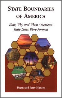
 State Boundaries of America: How, Why, and When American State Lines Where Formed offers far more information about state boundaries than I ever expected. Since I was a kid, I have loved looking at maps. On a U.S. map it’s easy to see where some state boundaries follow natural formations such as rivers, while others are marked by clear, straight lines. But, why exactly were these formations or lines chosen, who chose them, what made them official? These questions are answered through a review of some of the earliest documents related to these boundaries.
State Boundaries is not a map book. It is not even just a basic history. The book is a cross-referenced dataset of the portions of Royal Charters, Royal Grants, International Treaties, and U.S. Territorial or Federal Statues covering 300 plus years of history that created existing state boundaries. The author makes note that most state boundaries were in place long before the colonies, territories, etc. became states. The author’s intent is to:
- “delineate the source of each state line component
- codify them as natural (e.g. rivers) or otherwise and by what means
- provide how early each state boundary was a real irrefutable boundary before each “State” was politically admitted to the Union
- include sufficient detail and reference for further study”
Information in the book is presented in three parts, the boundaries, consolidated list of grants, and U.S. laws and treaties. Together, these parts give the details to understanding final state boundaries. This is an excellent reference for any library.
Table of Contents
Introduction
Original Thirteen (1606-1776)
Free or Slave (1776-1835)
Civil War ERA (1835-1862)
Sodbuster + (1862-1889)
Consolidated list of grants, treaties, U.S. Law
Appendices
- State Line Segments
- Relevant English Rulers 1509-1820
- Charters, Grants, Dominions, Provinces, Districts, Territories, States, Commonwealth, U.S. Statues, Other Terms
- Public Land Survey System
- Technology and Social Advances
- Modern Legal Boundary Definition Example: Virginia (1 OCT 2005)
Bibliography
References
Alphabetical State Index
State Boundaries of America: How, Why, and When American State Lines Where Formed is available from Family Roots Publishing; Price: $23.52.