The following is from the July 30, 2016 edition of Hoodline.com:
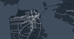
Once upon a time, San Francisco was crawling with streetcars. And thanks to the new interactive map Where The Streetcars Used To Go, history buffs can retrace their historic routes without leaving home.
The map, created by local designer Chris Arvin, combines data from four different sources to give viewers the names and photos of routes that operated in decades past, in comparison to the city’s streetcar network today.
Thanks to ResearchBuzz for the heads-up.
