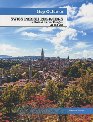
The Map Guide to Swiss Parish Registers – Vol. 12 – Canton of Glarus, Thurgau, Uri and Zug was printed this summer and is now available at the FRPC website. Following are the details…
Map Guide to Swiss Parish Registers – Vol. 12 – Canton of Glarus, Thurgau, Uri and Zug; by Kevan M. Hansen; 2019; 212 pp; 8.5×11; soft cover; perfect bound; ISBN: 9781628591811; Item #: FR0682
The Map Guide to Swiss Parish Registers series is an out-growth of the very popular Map Guide to German Parish Registers project, which is still in process, but nearing completion. Over the years, we’ve been asked by numerous parties to extend the project to cover other German-speaking European countries. We did that with the publication of Map Guide to Luxembourg Parish Registers in 2016. There are 26 current cantons in Switzerland. Historic Bern is covered in the first two volumes of this series, and makes up two of those 26, as the current Canton of Jura is in historic Bern Canton. Volume three covers Canton Zürich. Volume 4 deals with Canton Fribourg. Volume 5 covers Canton Aargau. Volume 6 covers Canton Sankt Gallen, Appenzell-Ausserrhoden and Appenzell Innerrhodden. Volume 7 covers Vaud (Waadt). Volume 8 covers Cantons Solthurn, Basel-Landschaft, Basel-Stadt and Schaffhausen. Volume 9 covers the cantons of Lucerne, Obwalden, Nidwalden, and Schwyz. Volume 10 covered about half of Graubünden. Volume 11 covered the other half of the Canton. Volume 12 (this volume) covers the cantons of Glarus, Thurgau, Uri and Zug. Many of the 26 Swiss cantons are small, so a number of guides contain multiple cantons.The full series will be 14 volumes upon completion.
Unlike American genealogical research, where the place to search is usually a civil registration (city, county, and state), European research is usually related to an ecclesiastical jurisdiction. In 18th and 19th century Switzerland, one must search the parish registers for births, christenings, marriages, deaths and burials. The historic boundaries for the Swiss cantons and amtsbezirke are quite well defined, and this volume lays them out in map form. Listings are given for both Catholic and Protestant parishes, along with what records are available and where to access them. Contact information, and the municipalities covered by each parish is found, making your Swiss research much easier to accomplish.
Each of the Map Guide to Swiss Parish Registers does the following:
- Identifies the major online resources for Swiss genealogical research.
- Identifies each canton with amtsbezirke (districts), and the municipalities, bauerten (farming coalitions), and subsidiary locations.
- Visually identifies church parishes within each amtsbezirk (district).
- Provides an overview of Swiss genealogical records.
- Identifies neighboring parishes, just in case your ancestor may have gone to an alternate parish.
- Aids in conducting area searches, particularly across district and canton borders.
- Provides visual identification of search areas in which to look for your family.
- Helps in determining proximity of one area to another.
- Identifies archives, repositories, and other resources.
- Identifies important gazetteers and online dictionaries available to researchers.
Map Guide to Swiss Parish Registers – Vol. 12 – Canton of Glarus, Thurgau, Uri and Zug; by Kevan M. Hansen; 2019; 212 pp; 8.5×11; soft cover; perfect bound; ISBN: 9781628591811; Item #: FR0682
Note – This volume is also available in a hardback edition
The following alphabetical list of 761 places are those found in the this volume covering Canton of Glarus, Thurgau, Uri and Zug.
- Aadorf Thurgau
- Aawangen Thurgau
- Abfrutt Uri
- Acherberg Uri
- Acherli Uri
- Adlenbach Glarus
- Aesch Uri
- Aeusseres Städtli Zug
- Affeltrangen Thurgau
- Allenwinden Zug
- Allmend Glarus
- Almensberg Thurgau
- Alosen Zug
- Altdorf Uri
- Alter Glarus
- Alterswilen Thurgau
