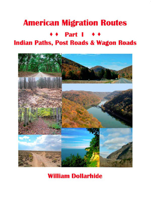
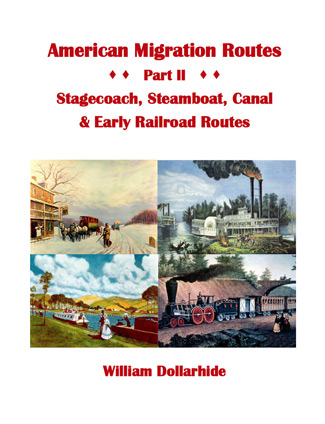
Family Roots Publishing is excited to announce that Bill Dollarhide’s new American Migration Routes – Parts I and II are now shipping at FamilyRootsPublishing.net. Notice – that the address ends with .net! That’s the new website. It’s under construction, but works great for the 400 items that are now posted – both books, as well as instantly-downloadable eBooks. The volumes are also available at Biblio.com, Amazon.com, and HeritageBooks.com. Autographed copies are available at the new site, as well as Biblio – at no extra charge.
20% Off through Tuesday, November 29, 2022 with Offer Code.
To celebrate the launch of FamilyRootsPublishing.net, and Early Black Friday, Black Friday, as well as Cyber Monday, FamilyRootsPublishing.net is offering an additional 20% off all items currently being sold in the Migration, Immigration and Emigration category with the offer code “Migration” – not case sensitive, and without the quote marks. NOTE: BE SURE AND ENTER THE OFFER CODE IN THE THE BOX AT CHECKOUT. OTHERWISE YOU WON’T GET THE DISCOUNT.
Following are the details on the two volumes:
 American Migration Routes Part I – Indian Paths, Post Roads & Wagon Roads; by William Dollarhide; 2022; 139 pp; Full Color Throughout; Soft Cover; Perfect-bound; 88 Maps; 77 Routes; ISBN 978-1-62859-335-8; Item #: FR0486
Did your ancestors migrate from one place to another within the United States between the years 1630 and 1869? Would you like to trace that migration path as it is today? Would you like to recreate that move – either by road-trip or virtually, while at home? This all-new book will allow you to do those things.
American Migration Routes, Part 1 includes 88 maps and 77 routes. It has seven (7) chapters, each illustrating a specific era of American transportation history:
1. Indian Paths to Post Roads (1630-1669)
2. The King’s Highway (1680-1765)
3. Scots-Irish Wagon Roads (1720-1750)
4. Trans-Appalachian Trails & Roads (1755-1796)
5. Roads to the Ohio Country (1787-1818)
6. Roads of the Old Southwest (1806-1832)
7. Western Migration Routes (1821-1869)
A 12-page Table of Migration Routes acts as an introduction to the map chapters with road trips, notes, and links to historical references online. Each chapter starts with a locator map and introduction to the historic era.
The migration routes are then enlarged on two side-by-side maps: the left-hand page has the highlighted trace of a migration route on a modern highway map; the right-hand page has the same trace on a county boundary map.
For all states, the Modern Highway Maps were adapted from the USGS National Map and show a highlighted old migration route as part of the current State, US, or Interstate Highways. These maps were designed to enable a road trip that follows the trace of the old migration route. At each numbered migration route, an arrow symbol indicates the road trip directions necessary to repeat the journey today.
The County Boundary Maps were adapted from the USGS Base Map of the U.S. No. 2b East as well as various other base maps showing current state and county boundaries. The county boundary maps were added for genealogists and the researchers who need to know the place on the ground where their ancestors may have left records of an event, i.e., a birth, marriage, death, or burial. Finding the place of an event necessitates a discovery of the exact cemetery, town hall, or county courthouse where the records are found today.
The volume also includes two appendices:
1. 1860s Travel Times on the Routes to San Francisco, California
2. The Trail of Tears: Routes of the Five Civilized Tribes. An historical timeline of the events leading to the Indian removals.
 American Migration Routes: Part II – Stagecoach, Steamboat, Canal & Early Railroad Routes; by William Dollarhide; 2022; 157 pp; 8.5×11; Soft Cover; Perfect bound; Nearly Full Color; ISBN 978-1-62859-337-2; Item #: FR0487
The Great Roads of 1840. Motivated by the need for clear, readable maps, this new American Migration Routes: Part II features descriptions of the same travel routes as Henry S. Tanner’s 1840 American Traveller; but adds all new maps for each of the forty-five travel hub cities from the 1840 guidebook.
Modern Highway Maps. The trace of an 1840 travel route is emphasized on a current road map. The base map used was the USGS National Map, an interactive mapping system online where incremental levels of detail are possible.
County Boundary Maps. The trace of an 1840 route also appears on an adjoining map showing the current county boundaries for the same area. The source for the county maps was the USGS Base Map of the U.S. 2A East, which is available online as a free PDF download.
Google Maps Links. Modern driving directions for each historic route are provided and hyperlinked to a preset Google Maps road trip.
Find the Right County – Discover the Records. A chronological list of birthplaces (by state) for a family found in census records may point to a particular migration route the family followed. A detailed map is needed next to reveal the names of states, counties, towns, and cities to search for evidence of people living there in the past.
Repeat the Journey. This book shows the towns & way-stops for 314 travel routes available in 1840 and the exact roads needed to repeat a journey today.
Sourced from The American Traveller. The primary resources for this new book were specific travel routes methodically described and mapped in The American Traveller; or Guide Through the United States, by Henry S. Tanner, 6th Edition, publ. Philadelphia, 1840.
“What a wonderful tool this guide will be! Three decades ago, the Dollarhide-Thorndale Census Maps revolutionized standards for the use of census records. Today, your American Migration Routes will set a new set of expectations for contextual research to ensure reliability in tracking ancestors and telling their stories. – Elizabeth Shown Mills, CG, CGL, FASG, FNGS, FUGA, Editor, National Genealogical Society Quarterly, 1987-2002
The following links can be used to purchase Parts I & II at FamilyRootsPublishing.net, Biblio, Amazon and Heritage Books. The paperback books sell for $39.95 each. The Paperback/eBook Bundle of either volume at FamilyRootsPublishing.net and Biblio is $49.95. Either book may be purchased as a PDF Ebook at FamilyrootsPublishing.net If ordering the bundle, the PDF eBook is immediately downloadable at FamilyRootsPublishing.net – or by eMail attachment to your email address received from Biblio ASAP – within 24 hours & usually much less:
FamilyRootsPublishing.net
American Migration Routes Parts I and II (paperback bundle of 2 soft-cover books)
American Migration Routes Part I – Indian Paths, Post Roads & Wagon Roads (paperback)
American Migration Routes Part I – Indian Paths, Post Roads & Wagon Roads (instantly downloadable eBook)
American Migration Routes Part I – Indian Paths, Post Roads & Wagon Roads (paperback and PDF eBook)
American Migration Routes: Part II – Stagecoach, Steamboat, Canal & Early Railroad Routes (Paperback)
American Migration Routes: Part II – Stagecoach, Steamboat, Canal & Early Railroad Routes (instantly downloadable eBook)
American Migration Routes: Part II – Stagecoach, Steamboat, Canal & Early Railroad Routes (Paperback & PDF eBook)
Biblio:
American Migration Routes Part I – Indian Paths, Post Roads & Wagon Roads (paperback)
American Migration Routes Part I – Indian Paths, Post Roads & Wagon Roads (paperback and PDF eBook)
American Migration Routes: Part II – Stagecoach, Steamboat, Canal & Early Railroad Routes (Paperback)
American Migration Routes: Part II – Stagecoach, Steamboat, Canal & Early Railroad Routes (Paperback & PDF eBook)
Amazon:
American Migration Routes Part I – Indian Paths, Post Roads & Wagon Roads (paperback)
American Migration Routes: Part II – Stagecoach, Steamboat, Canal & Early Railroad Routes (Paperback)
Heritage Books:
American Migration Routes Part I – Indian Paths, Post Roads & Wagon Roads (paperback)
American Migration Routes: Part II – Stagecoach, Steamboat, Canal & Early Railroad Routes (Paperback)